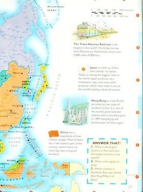


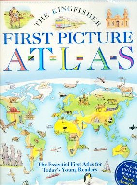


Beginning with a simple exploration of what maps are and how they are used, this first picture atlas includes a general survey map of each continent, as well as pictorial maps that detail each continent&&&^s main products and industries, physical features, and its characteristic wildlife and plants. Includes a large removable foldout map of North America.